The commune in numbers

open today 08:00 AM - 02:00 PM (without interruption)


Geography
- Surface area of the commune: 41km²
- Altitude: 241-429 m
Demography
Last update : 2nd of January 2024
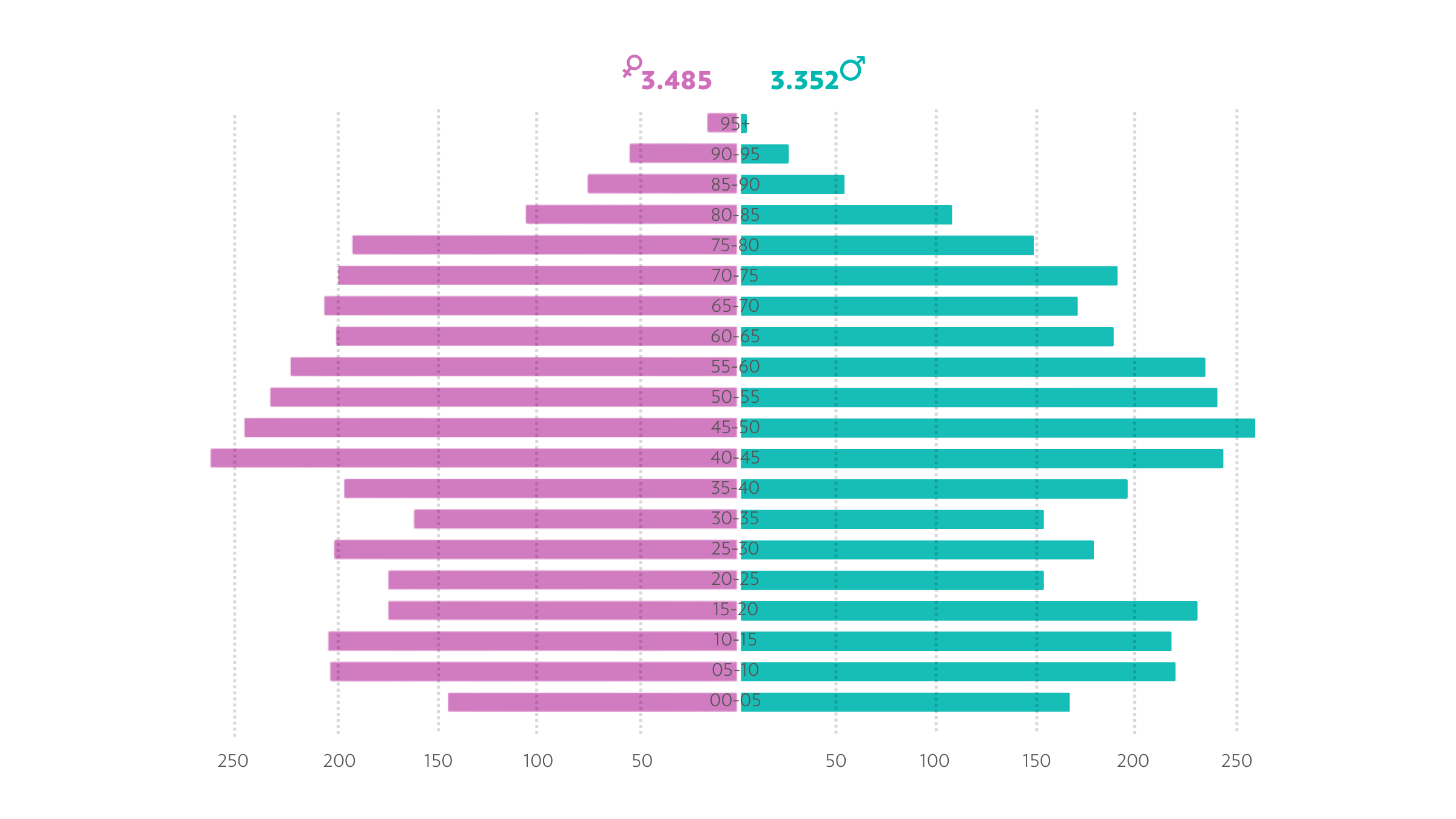
Composition of the population by gender (02.01.24)
Population: ~6.832
Inhabitants / km² : ~166
- Senningerberg: 1.853
- Niederanven: 1.537
- Rameldange: 890
- Oberanven: 795
- Senningen: 749
- Hostert: 557
- Ernster: 449
- Waldhof: 2
- Staffelstein: 0


